|
|
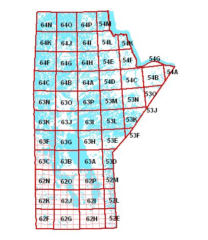
NOTE: Map reference system is the same
as the Government of Canada 1:50,000 NTS (National Topographic Series).
1:20,000 mapping datasets are not available for all NTS map sheets. An
index map is available
in shape format showing all datasets currently available.
The older 1:20,000 products ( 1995 or earlier ) generally contain hypsography ( spot elevations or contour
lines ); the newer products do not. The index map identifies these different coverages.
The coverages are lines and points and do not contain polygons.
Download Feature Codes
Download "Autoshp" for
.DXF
|