- About
- Admin. Boundaries
- Base Maps
- Cadastral
- Digital Elevation Models
- Digital Imagery
- Environment
- Forest Inventory
- Geographical Names
- Geology Mapping
- Hydrography
- Land Use/Cover Maps
- Municipal Maps
- Quarter Section Grids
- Soil Classification
- Spatial Referencing
- Topographic Maps
- Town & Village Plans
- Transportation
- Comments
Related Sites
Canada Map Sales

To view PDF files, you must have a copy of the Adobe Acrobat Reader which is available as a free download:
![]()
Manitoba Land Initiative
Core Maps - Data Warehouse
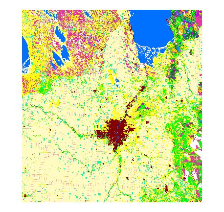
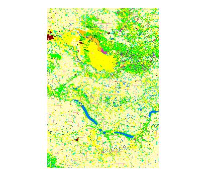
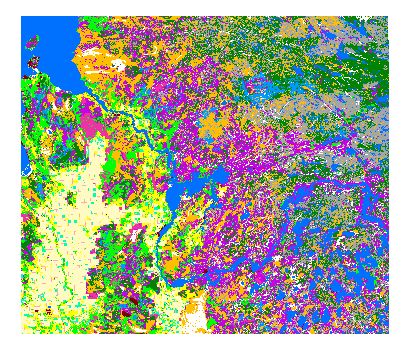
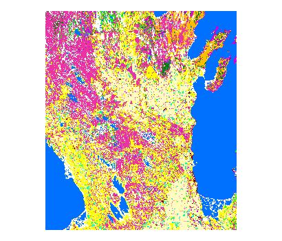
Land Use / Land Cover
NOTE: The .DXF, .SHP or .TIF download option provides a zipped package containing the various data layers for portions of the Province including, documentation files and a meta data file. The .GIF overview contains a sub-set sample of the overall map.
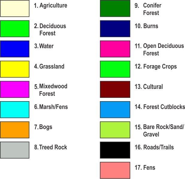
Download Land Use Legend for shapes Courtesy: Assiniboine Community College GIS Environmental Technologies program
Download Land Use Classification descriptions
Go to top| Dataset | |||||
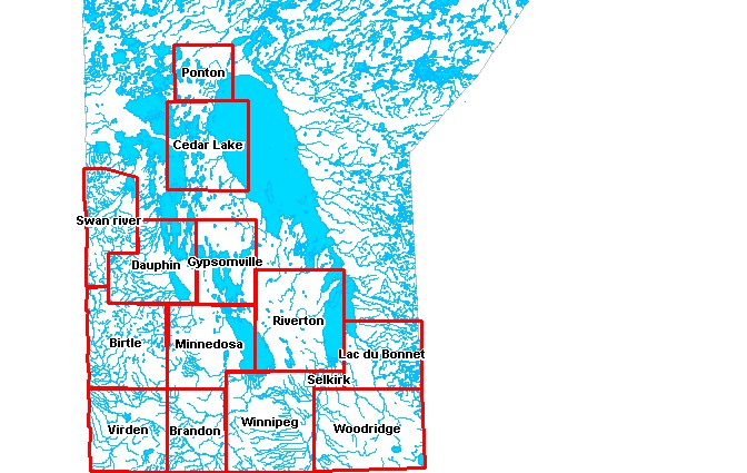
| Capital Region - 2001 | |||||
| Birtle - 2006 | |||||
| Birtle - 2001 | |||||
| Birtle - 1999 | |||||
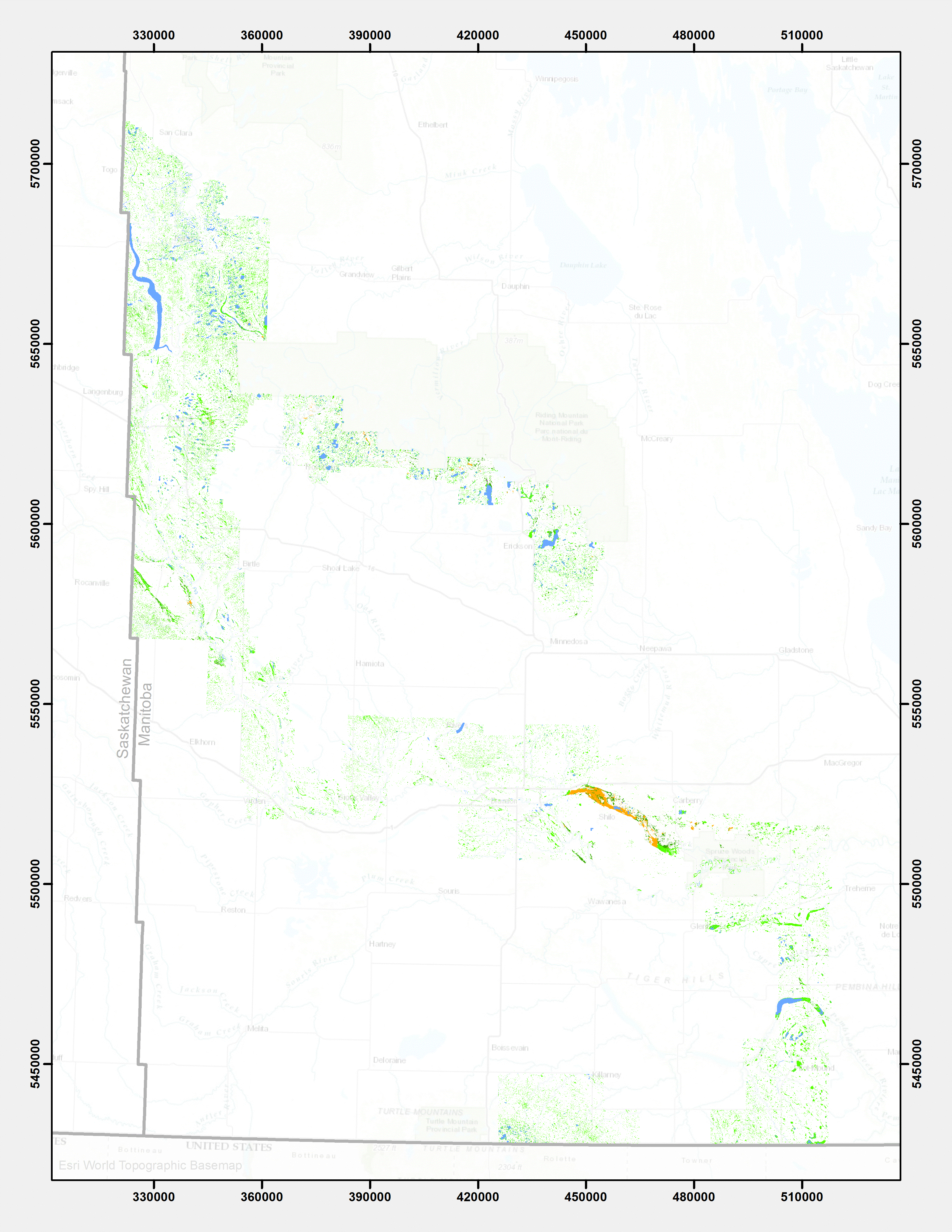
| Brandon - 2006 | |||||
| Brandon - 2000 | |||||
| Cedar Lake - 1989 | |||||
| Dauphin - 2005 | |||||
| Dauphin - 2002 | |||||
| Gypsumville - 2004 | |||||
| Gypsumville - 2000 | |||||
| Gypsumville - 1986 | |||||
| Lac du Bonnet - 2005 | |||||
| Lac du Bonnet - 2001 | |||||
| Minnedosa - 2004-2006 | |||||
| Minnedosa - 2000 | |||||
| Ponton - 1989 | |||||
| Riverton - 2005-2006 | |||||
| Riverton - 2002 | |||||
| Selkirk - 2006 | |||||
| Selkirk - 2001 | |||||
| Swan River - 2005 | |||||
| Swan River - 2002 | |||||
| Virden - 2006 | |||||
| Virden - 2000 | |||||
| Winnipeg - 2006 | |||||
| Winnipeg - 2001 | |||||
| Woodridge - 2005 | |||||
| Woodridge - 2001 | |||||
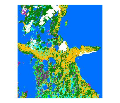
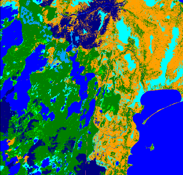
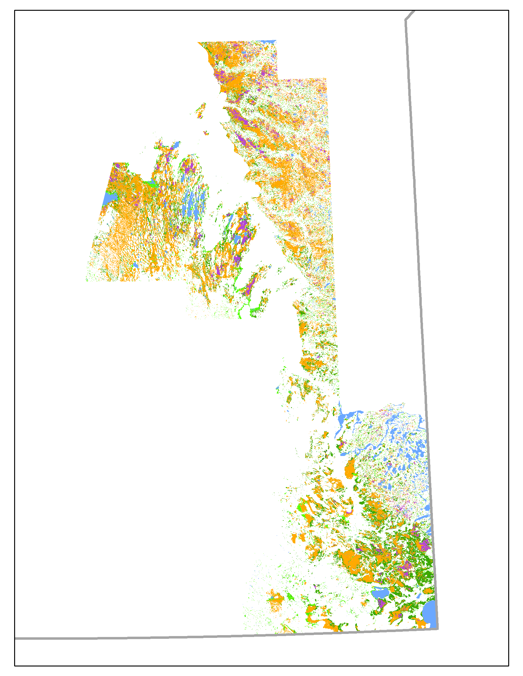
EOSD - (Earth Observation for Sustainable Development)
Provisional - under review
View Land Use Colour Legend| Dataset | |||||
| LUC_EOSD_Northwest | |||||
| LUC_EOSD_Northeast | |||||
| LUC_EOSD_Hudson_Bay_East | |||||
| LUC_EOSD_West_Central | |||||
| LUC_EOSD_East_Central | |||||
| LUC_EOSD_South | |||||
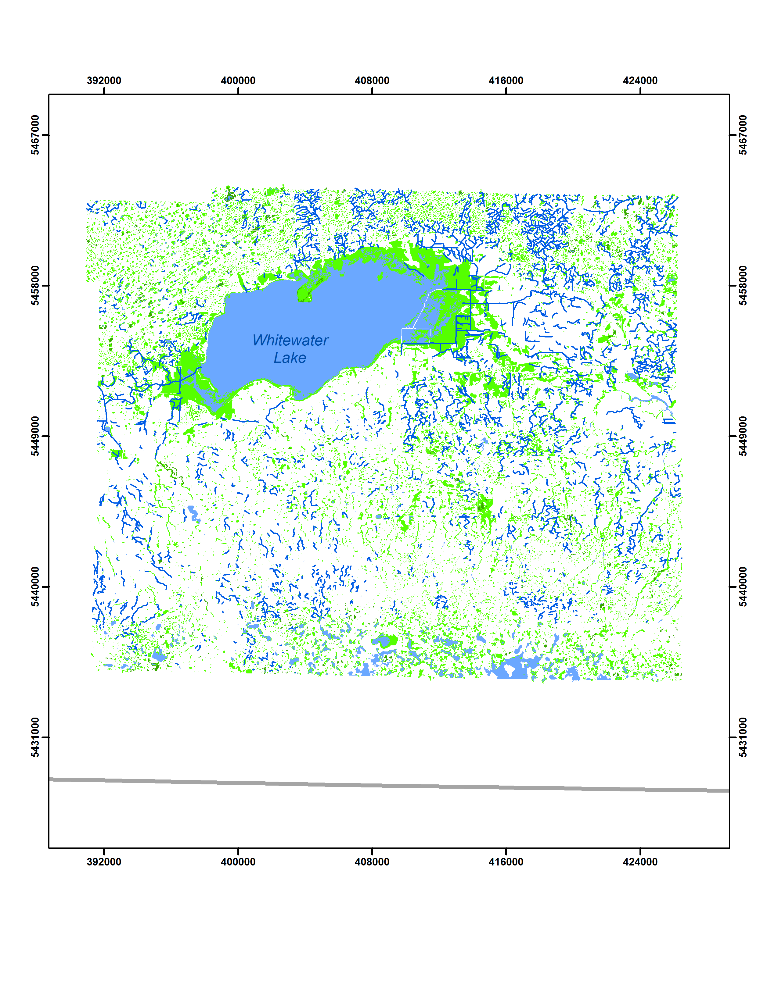
Wetland Inventory
| Dataset | |||
| Assiniboine River Valley, Turtle Mountain, Riding Mountain 2007 - 2010 | |||
| Southern Peatlands 2013 | |||
| Whitewater Lake 1958 | |||
| Whitewater Lake 2009 |